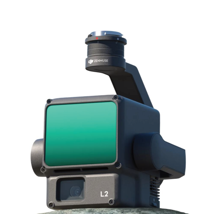
DJI Zenmuse L2 – LiDAR Mapping Payload for Matrice 300/350 RTK | 450m Range, 20MP RGB, RTK/IMU Precision

In stock
- SKU
- DZLiDAR
Description
| Feature | Description |
|---|---|
| Payload Type | Integrated LiDAR + RGB Camera |
| Laser Module | Livox Lidar Module (Linear, Non-repetitive Scanning Pattern) |
| Point Cloud Rate | Up to 240,000 points/sec (Single Return); 1,200,000 pts/sec (Multiple) |
| Detection Range | Up to 450m (at 80% reflectivity, 0 klx); 250m typical operation |
| Accuracy | Vertical: ±4 cm |
| Field of View | Horizontal: 70.4° |
| RGB Camera | 4/3 CMOS |
| Laser Class | Class 1 (Eye Safe) |
| GNSS + IMU | Integrated IMU and RTK for centimetre-level georeferencing |
| Mount Compatibility | DJI Matrice 300 RTK / Matrice 350 RTK (Top or Bottom Mount) |
| Data Formats | .las, .pcd, .dxf, .ply, .sbf, .tif (via DJI Terra) |
| Supported Software | DJI Pilot 2 (Flight), DJI Terra (Post-Processing), 3rd Party Compatible |
Key Features
-
Highly Accurate Point Clouds: Capture dense, high-precision 3D models in real-time
-
Integrated RGB Mapping Camera: Combines colourised point clouds with rich visual context
-
Long-Range Performance: Capture terrain, powerlines, forests, buildings from up to 450m
-
Real-Time Terrain Follow: Maintains altitude over uneven land for uniform results
-
IMU + RTK Integration: Absolute positioning accuracy for survey-grade output
-
All-In-One Design: Lightweight, single gimbal system – no balancing needed
What’s in the Box?
-
DJI Zenmuse L2 Payload (LiDAR + RGB)
-
Gimbal Adapter & Screws
-
Lens Cover
-
Transport Case
-
Quick Start Guide
-
(Optional: DJI Terra Pro Software Licence)
Best For:
-
Topographic Surveys & Land Mapping
-
Forestry & Vegetation Management
-
Mining & Quarry Volume Measurements
-
Power Line & Infrastructure Scanning
-
Flood Risk & Watershed Modelling
More Information
| Smart Phone | No |
|---|---|
| Enable Call for Price | No |
